The Great British Walk is one of the country’s most ambitious long-distance walking routes, linking the southern tip of England with the far north of Scotland. The route passes directly through Sutton Park, giving the park an unexpected place in Britain’s long-distance walking heritage. The section through the park – commonly known as the Morse Code Walk – covers approximately 3-4 miles of outstanding heathland, lakeside, and woodland walking and has been referenced by walkingenglishman.com (DR56) as one of the finest urban sections of any long-distance route in England. Whether you are tackling the full Great British Walk or simply exploring a classic section of it for a day out, this guide tells you everything you need to know.
The Great British Walk
The Great British Walk (GBW) is an unofficial long-distance walking route of approximately 1,400 miles, running from Land’s End in Cornwall to John o’Groats in Caithness. Unlike the formal National Trails (which are waymarked and maintained by Natural England and its devolved equivalents), the GBW is a route devised by walkers for walkers – a creation of the amateur long-distance walking community that has been refined over decades of use. Its routing prioritises interesting, varied, and scenic walking over the shortest or most direct path, and it passes through an unusually diverse range of landscapes.
The route through the Midlands presents a particular challenge for any long-distance walker: how to cross the vast conurbation of Birmingham without either a tedious roadside slog or an interminable detour. The Great British Walk’s solution is elegant: route the path through Sutton Park, the enormous National Nature Reserve on Birmingham’s northern edge, giving walkers a genuine countryside experience for the 3-4 miles through the park before emerging in the leafy suburbs of Sutton Coldfield.
Why It Is Called the Morse Code Walk
The name “Morse Code Walk” is a piece of walkers’ folklore associated with the Great British Walk’s passage through the Midlands. According to the tradition, the route’s pattern of long straight sections and short diversions, when plotted on a map, was fancifully compared to the dots and dashes of Morse code. The name has stuck among long-distance walking enthusiasts as an affectionate description of this section of the route, and it is the term most commonly used to refer to the GBW’s passage through Sutton Park.
The Route Through Sutton Park: Step by Step
The Great British Walk enters Sutton Park at Streetly Gate on the A454 Streetly Lane in the south-west of the park. This is the standard starting point for walkers following the route northward through the Midlands section.
From Streetly Gate, the route heads east across the open heathland of the western park, passing near Keeper’s Pool on its north-eastern shore. This section gives an immediate and dramatic impression of the park’s scale: the heathland stretches away in all directions, the only landmark the distant tree-lines around the pools and the raised line of Icknield Street (the Roman road) cutting north-south in the middle distance.
The route then joins Icknield Street (the Roman road, approximately 1,900 years old) for a memorable straight-line section heading north across the heathland plateau. Walking the raised agger of the Roman road – its straightness and elevation still clearly visible after nearly two millennia – is one of the most atmospheric moments of the whole GBW route. The Roman road section extends for approximately 1 mile through the central park.
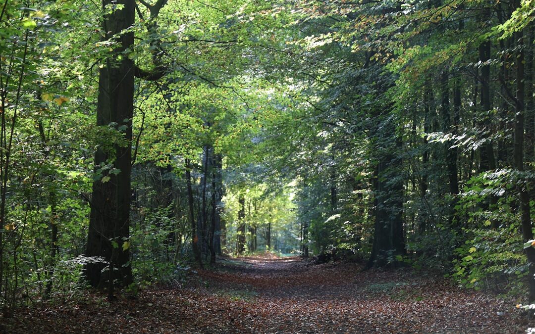
Leaving the Roman road, the route curves east past the northern shore of Blackroot Pool, the most secluded of the park’s seven lakes. The wooded northern shore of Blackroot Pool offers a complete contrast to the open heathland: dense birch woodland, the sound of the inlet stream, and the possibility of a kingfisher along the waterway.
The route exits Sutton Park at Blackroot Gate on Blackroot Road, from where it continues north-east through the suburb of Four Oaks and onwards towards Lichfield. The total distance through the park from Streetly Gate to Blackroot Gate is approximately 3.5 miles.
Practical Information for Walking the Route
Starting point: Streetly Gate car park, Streetly Lane (A454), B74 3AD. Regular bus services between Sutton Coldfield town centre and Streetly serve this point.
End point / return transport: Blackroot Gate is on Blackroot Road, B74. Bus services run from Blackroot Road back to Sutton Coldfield town centre (approximately 2 miles), from where trains run to Birmingham New Street on the Cross-City Line. Alternatively, the walk can be made as a there-and-back route, retracing the same path for a total of 7 miles.
Distance: Approximately 3.5 miles one-way through the park. Allow 1.5-2 hours at a steady walking pace, more if stopping to explore the pools or the Roman road.
Terrain: Mostly firm gravel paths and maintained tracks across open heathland and woodland. Some sections can be muddy after prolonged rain, particularly near the pool margins. Walking boots are strongly recommended. The heathland terrain is largely flat with minor undulations.
Navigation: The route is not officially waymarked as the Great British Walk but is straightforward to follow using a 1:25,000 OS map (Explorer 220 Birmingham) or OS Maps app. Key landmarks – Streetly Gate, Keeper’s Pool, Icknield Street, Blackroot Pool, Blackroot Gate – are clearly marked on the OS map and visible on the ground.
What You Will See: Highlights of the Route
Open heathland: The first section from Streetly Gate crosses classic lowland heath, with ling heather, gorse, and silver birch scrub. In late summer (August-September) the heather is in full flower – a purple carpet that transforms the landscape.
Keeper’s Pool: The route passes near the northern shore of Keeper’s Pool, one of the park’s most picturesque lakes. Watch for great crested grebe on the water and grey heron in the shallows.
The Roman road: The elevated agger of Icknield Street is the single most historically significant feature of the walk. The combination of extreme age (1,900 years) and perfect straight alignment across the heathland is deeply impressive.
Blackroot Pool woodland: The final section through the birch woodland around Blackroot Pool provides welcome shade in summer and wonderful colour in autumn. The pool itself is worth a short detour for birdwatching or simply for the beauty of the setting.
Tips for the Walk
Waterproof boots or wellies are advisable in winter and after rain. The open heathland provides little shelter from wind; bring a windproof layer even in summer. The park has no facilities on the route between Streetly Gate and Blackroot Gate – bring water and snacks for the walk. The nearest refreshments are at the Blackroot Gate end, where the Three Crowns pub on Birmingham Road is a short distance away.