Sutton Coldfield Present Day
![]()
  Various Images from within modern Sutton Coldfield. The idea behind this page is I get requests from people who have left Sutton Coldfield for abroad in the main and want to know what x, y, or z now looks like |
|
2001  Trinity Church Sutton Coldfield Jan 2001 - now has its own page |
 The Lych Gate, Trinity Church, & Rectory Cottages Sutton Coldfield - Jan 2001 |
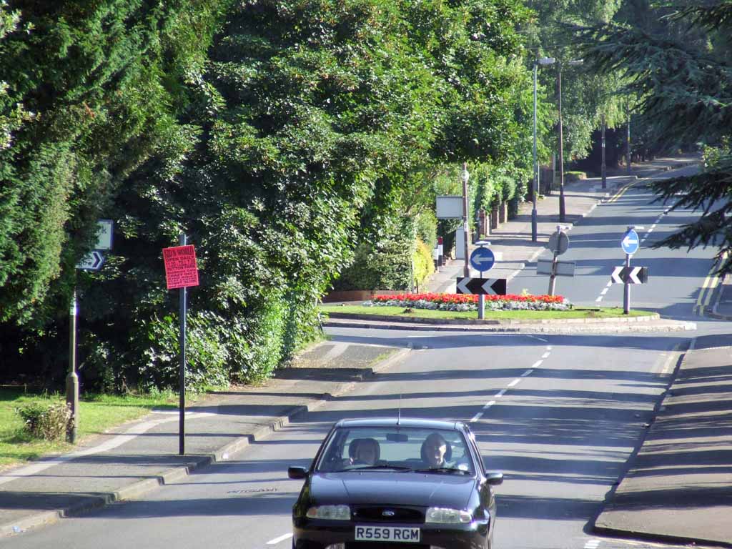
 And in the opposite direction, the High Street Conservation area, the road to Lichfield - Jan 2001. The building with the red fascia panel on the right was once a Hovis Bakery, The building with the spire and the one beyond were banks not so long back. |
 |
|
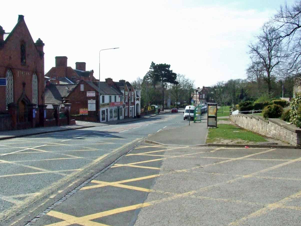
The railway passes over Coleshill Road after passing through Sutton Park (Nov
2001) and past the site of the former Sutton Park station. The building behind the bridge is the Electric Light Station  Looking back towards Sutton Coldfield Town Centre from Reddicap Hill (Nov 2001) |
 Bishop Vesey's Manor, now an antique shop - Jan 2001. Stands on Maney Corner on Maney Hill. 
Coleshill Street from Vesey Memorial Gdns.
Image: David Wilcox
2003  |
The Parade Shopping Centre 2003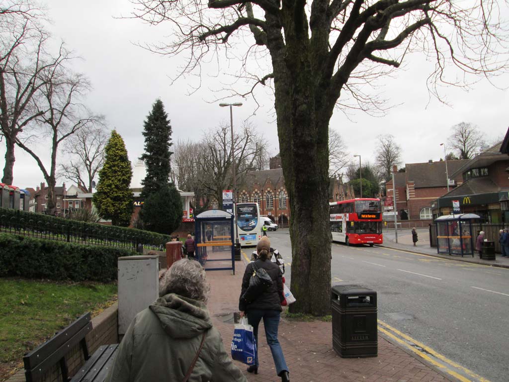 |
 |
| Trinity Church - March 26th 2003 |
 Fire Station, Courts and Police Station on the right and Sutton Coldfield College comes up on the left - 26 March 2003 |
 |
| Reddicap Hill - 26 March 2003 |
 |
| Gracechurch Centre In 1974 the Gracechurch Centre was built on the demolished ruins of The Parade. Now known as The Mall, but everyone ignored the name change and its still the Gracechurch Centre. It was once full of shops selling everything from a carrot to a car, but the Centre was bought out by an American Company, the rents soared, and the smaller friendlier shops were forced out in favour of the mobile phone shop and the glitzy tacky shops. Name changes ignored also include over the road at the Sainsburys Centre, but Sainsbury's left us, and its now supposedly known as the Red Rose Centre (I didn't know that!!) but to everyone its Sainsbury's and we call it Sainsbury's car park. Almost every month or so there is a store with 'Closing Down' on its windows. Behind the centre, on Brassington Avenue (see above image) a thin strip of land was bought for even more new buildings, but this seems to have died a death, with board covering a rapidly overgrown site and former car park. 2103: It has been sold by the American owners for £38m to the same compnay that owns the Manchester Arndale Centre and others. |
|
2004 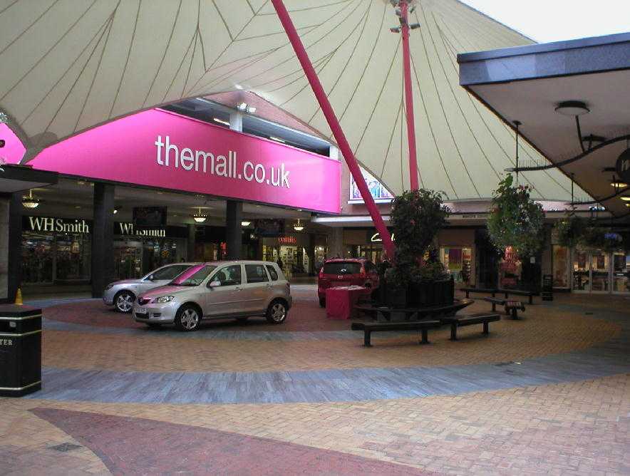   |
| Reddicap Hill 13th Feb 2004 |
  and below, what formerly stood on this site   The sign denoting Royal Sutton Coldfield almost hidden in the roundabout bushs          |
|
Easter Weekend April 2007  Sutton Coldfield has changed more in the past two or three years than in all the time since I arrived here in the early 90s. Development is filling in almost every spare space, between homes, removing homes to build on and people selling small patches of land for apartments. Good Hope Hospital is not immune to the greed of people. They have closed down a busy and well used Social Club to make way for an extra car park. All for 28 cars! |
 |
| This is what was a busy Child's Day Nursery, now lost forever to the developer (Churchill) who built "Retirement Apartments". A trend reflected everywhere in Sutton Coldfield for people who can afford ridiculous figures for apartments thrown up in a matter of weeks! If these are examples of Labour's promised "affordable housing" then someone, somewhere, is ripping us off big style. Now in 2013, its a block of luxury flats. |
 Here, in this image below, is another example of how these "Luxury" apartment's are springing up everywhere. In this case a complete row of Victorian houses were torn down in Hollyfield Road to make way for this. It is very obvious to see who is to blame for all this, Birmingham Council, in their quest for more and more revenue, from the good people of Sutton Coldfield. But, nobody can afford them except for the fly boy, whizz kids, both working, BMW driving family of 2! My daughter wants an apartment nearby to where we live but cannot afford their asking prices and she has a VERY good job. My youngest daughter will never be able to afford such accommodation and she is a Head Vet Nurse! |
 |
| This is Hollyfield Road. A nice road, busy during the rush hour and at school times but nice - on the surface. Between those houses, where once stood large, spacious back gardens now there are, in some cases, little turnings between homes, where developers have squeezed a driveway in between the houses to make access for the town homes built on someone's back garden! Greed! Grass is giving way to brick and breeze block. The Councils allow it because it generates another £1000 or so a year. |
 |
| Looking over Rectory Park tree's towards Town Centre. I wonder how long it will be before the council decide to do away with the park on the dubious grounds of needed for car parks for hospital, or lack of use by the community? Having a whinge? Yes, of course I am, I am watching what was a lovely area vanishing rapidly under the JCB. The park is alrady under threat due to staff and visitors to the Hopsital parking on park users car parks. This is all since the hospital, in its greed, instituted car park fees on what was a free car park. |
 |
| Sunday morning in April. Opposite the Police & Fire stations. Is that someone nicking the lead??? Bishop Vesey Grammar School |
 |
| From the same spot, outside Fire Station. Sutton Coldfield College is down on the left, opposite the Police Station. Most of the students migrate in from Birmingham. |
 |
| Looking in the opposite direction, from opposite the "Community" Fire Service, looking towards Mere Green. The once large hotel, top of the road, right of the image, is now - yes, you've guessed it - "luxury apartments"!!! Seen here on the right in July 2011 |
 |
| From Left to Right, Police Station and the Magistrates Court, now closed. The Royal Hotel can been seen at the bottom |
 Tamworth Road, looking east Anchorage Road (requested by an expat from this road) |
 Anchorage Road (taken for an ex pat who lived there) |
 |
 |
|
|
 |
 Coleshill Road |
 Upper Clifton Road |
 Clifton Road |
 |
 |
|
2. January 2009 |
 |
|
Sign of the times for 2009.
A major national department store gone to the wall and closed down in the
Recession which threatens to ends all recessions? Part of this is now a clothes shop. (2013) edit: 2020 and over 20 stores now closed down |
 |
|
Riland Road on a bleak, damp January
morning, traffic still in the "rush" stage, when it can get past
the parked cars. The large red building is the Victorian Electric Light Station |
 |
|
Riland Road, no room to pass due to the
amount of cars parked where they like. These two, "shall not pass". The car eventually realised he was going nowhere and reversed to allow the bus to pass. Mind you, the bus driver is not helping |
 |
|
Its amazing what you see when you walk off the beaten track. Here we
have a model railway shop which I never even knew existed!! It's in
Riland Road I hardly ever see it open nowadays |
 |
|
Off Ryland Road, is Ryland Grove. Its looks
ideal and peaceful considering its surrounded by a freight railway and
busy major roads. |
 |
| Sutton Coldfield was not made with traffic in mind and its shows theses days. Onto Rectory Road and looking towards Trinity Church |
 |
|
On Rectory Road, the local Royal British
Legion Branch. |
 |
|
This is a memorial to Nicola Dixon was who
murdered here in New Years Eve 1996. This is artwork that she did
at school. Thanks to Rob Beattie for this information. Its now 2103 and I am not sure if the killer was ever caught? |
 |
| Church Hill (Near the scene of Nicola's murder) and bwlow, look back up |
   Lots of empty shops here now incl M&S |
|
|
High St Conservation Area Formerly Council Offices, now apartments. Town Hall rear right |
 |
|
Skyline showing the top of the Victoria Road
Car Park over the Baptist Centre rooftop |
 |
|
Gate Inn. Was once known as the rather stupid
name of "The Case is Altered"! A short lived 'wine bar' - what a
joke! The Gate was originally on Park Road and lewd to the gateway to the Sutton Park, but Park Road eventually disappeared at this end of town. |
|
|
|
The source of almost all the litter
in Sutton Coldfield town centre - litter generator fast food joint.
This litter can be seen in the image of the footpath leading back up to
the church. It also litters the roads where it is thrown from car windows. |
 |
|
Gracechurch Shopping Centre. Not as pretty as
you would imagine considering the landlords are driving small businesses
out of the town by exorbitant rents. We had some really nice little shops here including a nice green grocer , they now had to leave due to expensive rents. Many others had left before, and since. 2013 - the Yanks have pulled out and sold it to another compnay for £38m |
|
3. January 2011 - A Walk Around Town |
 |
 |
 |
 |
 |
 |
 |
Coleshill Street heading up towards the top of Trinity Hill - July 2011 Coleshill Street. further down you cannot walk on the pavement because of the idiots who do not live here parking cars ON the pavement. 2013 as a result of my complaining to the Council, they double yellow lined one side of the road |
| Next Four - Bishop Vesey Grammar School |
 |
 |
 |
 |
 Moathouse July 2011 |
 Guildhall next to Grammar School |
 Anti pigeon wiring looking like an aerial to heaven (formerly a church!). |
 |
| High Street building 2013  Plantsbrook |
 Mill Street |
 |
Police Station & former Magistrates Courts July 2011. I understand that the police have actually
been seen in the Station now and then! |
 |
On a very old map of this junction, Railway Road & High Street, there is no street but a tunnel under which steam locomotives would pass |
 |
| Church Hill March 2013 |
 |
| The former Town Hall from the railway station |
 |
| Rectory Road Cottages opposite the Boot Inn - Mar 2013 |
 |
| Rectory Road/Whitehouse Common/Hollyfield Road junction |
 |
| St Chads Hollyfield Road |
 |
| Whitehouse Common - the former Esso Garage is now as Esso Tesco shop, they do not sell anything for cars!! |
 |
| Whitehouse Common Road to Rectory Road Lights |
| February 2014 |
 Boot Inn, now again, searching for another owner - Feb 2014  Junction Riland Road/Rectory Road - 20th Feb 2014 |
 Feb 20th 2014 |
 Rectory Road leading to Trinity Church Feb 20th 2014 |
 This used to be the road leading to the Sutton Coldfield TA Centre and to Defence Estates, the latter is still there but hidden in a forest of homes |
 St Georges Barracks was on the left, up the hill, no longer there |
 Victoria Road from Station Road 10 Mar 2014 |
 Queen Street |
 |
| Feb 2015 |
![]()
http://www.youtube.com/watch?v=sPTxz142PWw&feature=related
http://www.youtube.com/watch?v=-Nq5gryPZlE&feature=related
http://www.youtube.com/watch?v=yEAVN5SffqE&feature=related
http://www.youtube.com/watch?v=AbVeSmhDl5w&feature=related
http://tx.mb21.co.uk/gallery/suttoncoldfield/index.php
http://heritage.elettra.co.uk/artdeco/profile.php?building=empire
http://en.wikipedia.org/wiki/Sutton_Coldfield
http://www.suttoncoldfieldtowncentre.co.uk/town-history/
'The Old Photographs of Sutton Coldfield' Compiled by Marion Baxter
http://www.greyhoundderby.com/Closed%20Courses%20New.html
http://www.suco.co.uk/ http://www.tigersunited.com/history/p-kmiles.asp Ken Miles http://findarticles.com/p/articles/mi_qn4158/is_20040512/ai_n12788010 Lee Vale-Onslow
http://www.newhallmill.org.uk/newhall.htm - Friends of New Hall Mill http://www.suttoncoldfieldobserver.co.uk/index.jsp Sutton Coldfield Observer
http://icsuttoncoldfield.icnetwork.co.uk/ - Sutton Coldfield News http://www.thisissuttoncoldfield.co.uk/
http://www.british-history.ac.uk/report.aspx?compid=42686&strquery=sutton%20coldfield#s9

